torchgeo/torchgeo
torchvision for satellite imagery, minus the RGB assumptions
TorchGeo makes PyTorch work with satellite imagery by handling coordinate systems, spectral bands, and massive rasters for you.
Not currently ranked — collecting fresh signals.
star history
What it does
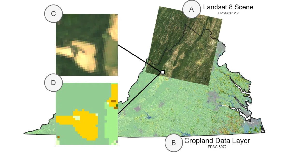
TorchGeo is a PyTorch domain library for geospatial and remote-sensing data, positioned as a companion to torchvision. It provides datasets, samplers, transforms, and pre-trained models that handle the usual satellite-imagery headaches: multispectral bands beyond RGB, varying spatial resolutions, and mismatched coordinate reference systems. You can compose datasets from multiple satellites or sources using set-style union and intersection operators, and the library automatically aligns projections and resolutions.
The interesting bit
It is the first library to support pre-trained weights for multispectral sensors like Sentinel-2, adopting torchvision’s multi-weight API so you aren’t stuck with RGB ImageNet baselines. It also bundles PyTorch Lightning datamodules and trainers with fixed train-val-test splits to reduce boilerplate and improve reproducibility.
Key highlights
- Geospatial datasets automatically reproject to a common CRS and resolution when composed
- Set operators (
UnionDataset/IntersectionDataset) let you merge or overlap satellite sources without manual alignment - Benchmark datasets for classification, segmentation, object detection, and change detection that return dictionary-style samples
- Pre-trained weights for non-RGB sensors via torchvision’s multi-weight API
- Lightning datamodules and trainers for reproducible experiments
Caveats
- Some datasets require you to bring your own imagery (e.g., Landsat), while others auto-download and checksum
Verdict
Remote sensing researchers and ML practitioners who want to skip geospatial data-wrangling should start here. If your data is already tidy RGB images, plain torchvision is still simpler.
Frequently asked
- What is torchgeo/torchgeo?
- TorchGeo makes PyTorch work with satellite imagery by handling coordinate systems, spectral bands, and massive rasters for you.
- Is torchgeo open source?
- Yes — torchgeo/torchgeo is open source, released under the MIT license.
- What language is torchgeo written in?
- torchgeo/torchgeo is primarily written in Python.
- How popular is torchgeo?
- torchgeo/torchgeo has 4.2k stars on GitHub.
- Where can I find torchgeo?
- torchgeo/torchgeo is on GitHub at https://github.com/torchgeo/torchgeo.