trailbehind/DeepOSM
Teaching neural nets to spot bad map data from space
DeepOSM uses OpenStreetMap labels to train a network that finds roads in satellite imagery—and flags where the map might be wrong.
Not currently ranked — collecting fresh signals.
star history
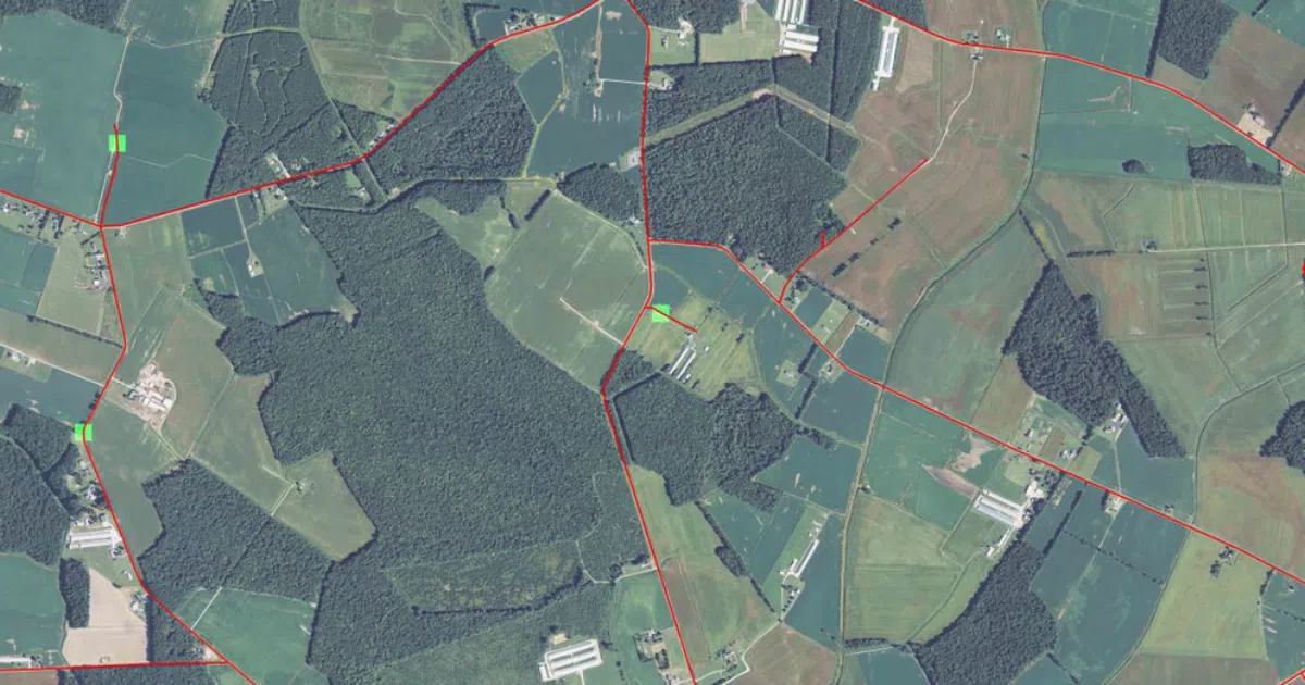
What it does DeepOSM downloads NAIP satellite imagery (1-meter resolution, RGB plus infrared) and OpenStreetMap vector data for the same area, tiles them into 64×64 chunks, and trains a TensorFlow neural net to predict whether the center 9 pixels contain a road. It then renders JPEG overlays showing predictions, labels, and “false positives” where OSM claims a road exists but the model disagrees.
The interesting bit The project inverts the usual crowdsourcing flow: instead of humans correcting maps, it trains a machine to audit the map by learning from the map itself. The default run covers ~200 km² of Delaware and reportedly hits 75–80% accuracy after about a minute of training on a single fully-connected ReLU layer—suggesting this is more proof-of-concept than production pipeline.
Key highlights
- Data pipeline fetches NAIP tiles from a Mapbox S3 requester-pays bucket and OSM PBF extracts from Geofabrik
- Dockerized setup with optional
nvidia-dockerfor GPU acceleration - Outputs overlaid JPEGs for visual inspection of predictions vs. ground truth
- Includes Jupyter notebook path for experimentation
- Cites Mnih’s 2013 thesis on aerial image labeling as theoretical foundation
Caveats
- Requires AWS credentials with a credit card on file (S3 requester-pays costs “a few cents”)
- “Very limited test suite” per the README’s own admission
- Single fully-connected layer is deliberately simple; accuracy ceiling is modest
- Last meaningful commit activity appears to be 2016–2017 era (TensorFlow 1.x,
nvidia-dockerv1.0.1)
Verdict Worth a look if you’re building map-validation pipelines or teaching a class on geospatial ML. Skip it if you need state-of-the-art segmentation—modern alternatives like SpaceNet challenges or Sentinel Hub have moved well past this architecture.
Frequently asked
- What is trailbehind/DeepOSM?
- DeepOSM uses OpenStreetMap labels to train a network that finds roads in satellite imagery—and flags where the map might be wrong.
- Is DeepOSM open source?
- Yes — trailbehind/DeepOSM is open source, released under the MIT license.
- What language is DeepOSM written in?
- trailbehind/DeepOSM is primarily written in Python.
- How popular is DeepOSM?
- trailbehind/DeepOSM has 1.3k stars on GitHub.
- Where can I find DeepOSM?
- trailbehind/DeepOSM is on GitHub at https://github.com/trailbehind/DeepOSM.