atiilla/GeoIntel
GeoIntel: Let Gemini guess where your photos were taken
It outsources photo geo-location to Gemini and packages the guesswork as structured OSINT data.
Not currently ranked — collecting fresh signals.
star history
What it does
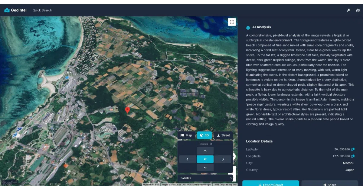
GeoIntel is a Python wrapper that feeds images to Google’s Gemini API and asks it to identify where they were taken. It returns structured JSON with guessed city, country, coordinates, and a self-reported confidence level (High, Medium, or Low). You can use it via command line, a drag-and-drop web interface, or as an importable SDK.
The interesting bit
The project treats a general-purpose vision model as a dedicated geo-location engine, complete with an interactive map and the polite fiction of confidence scores generated by the model itself. It is essentially glue code that packages an LLM’s visual speculation into OSINT-friendly JSON.
Key highlights
- Accepts local images or URLs, optionally spiced with user hints (
--context,--guess) - Returns structured JSON with coordinates, reasoning, and self-assessed confidence tiers
- Bundles a web UI with drag-and-drop upload and embedded Google Maps
- Usable as a CLI tool, web app, or Python SDK (
geointel.locate()) - Ships with a stern disclaimer that it is for “educational and research purposes only”
Caveats
- The README itself warns that predictions are “not guaranteed to be accurate”
- It is fundamentally a thin wrapper around a single Gemini API call with JSON parsing
- The “interactive 3D Google Maps” feature is mentioned but not demonstrated beyond a screenshot reference
Verdict
Worth a look if you need a quick prototype for AI-assisted image geolocation, but skip it if you were hoping for on-device analysis or anything more sophisticated than asking Gemini nicely.
Frequently asked
- What is atiilla/GeoIntel?
- It outsources photo geo-location to Gemini and packages the guesswork as structured OSINT data.
- Is GeoIntel open source?
- Yes — atiilla/GeoIntel is open source, released under the MIT license.
- What language is GeoIntel written in?
- atiilla/GeoIntel is primarily written in HTML.
- How popular is GeoIntel?
- atiilla/GeoIntel has 1.1k stars on GitHub.
- Where can I find GeoIntel?
- atiilla/GeoIntel is on GitHub at https://github.com/atiilla/GeoIntel.